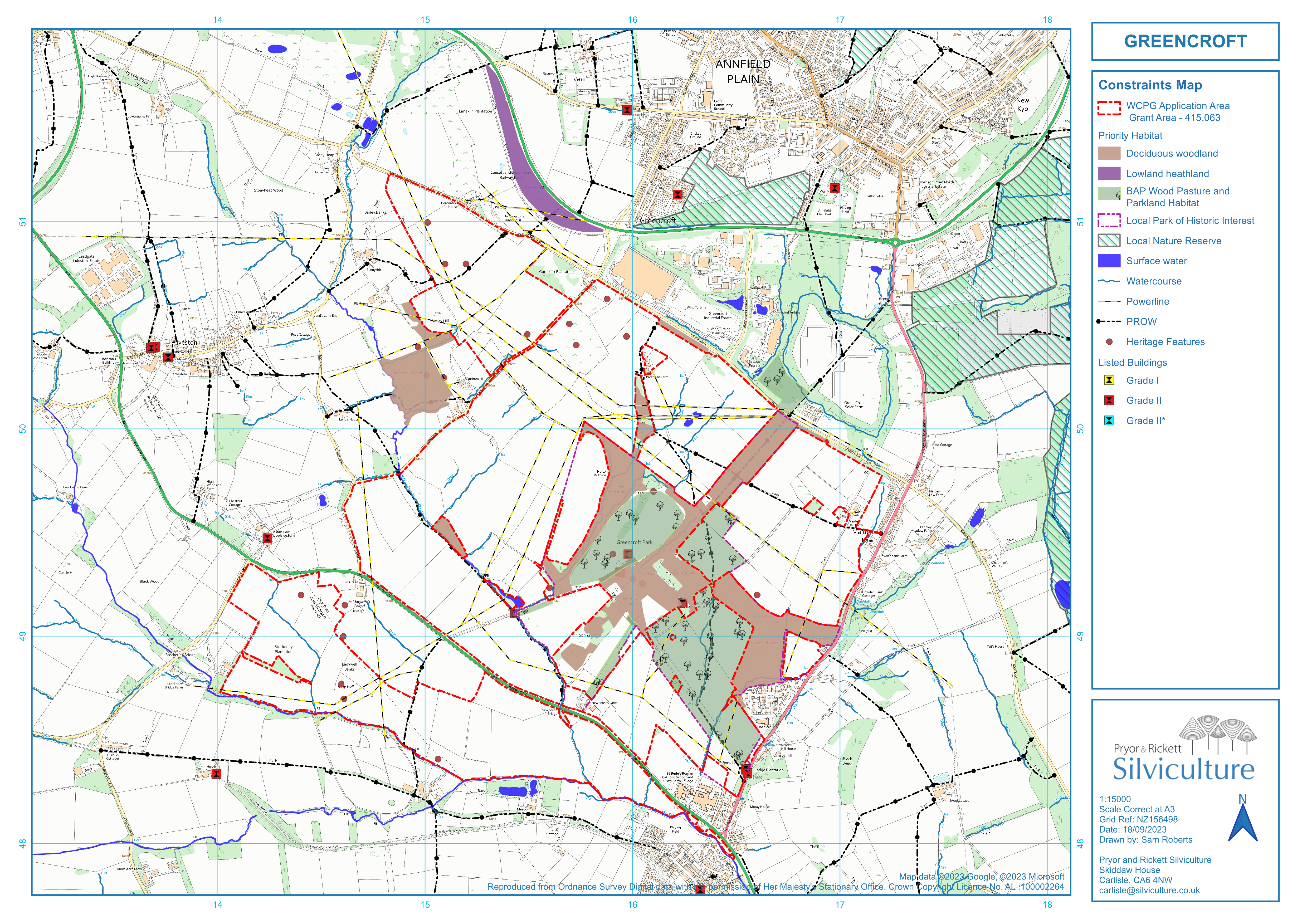
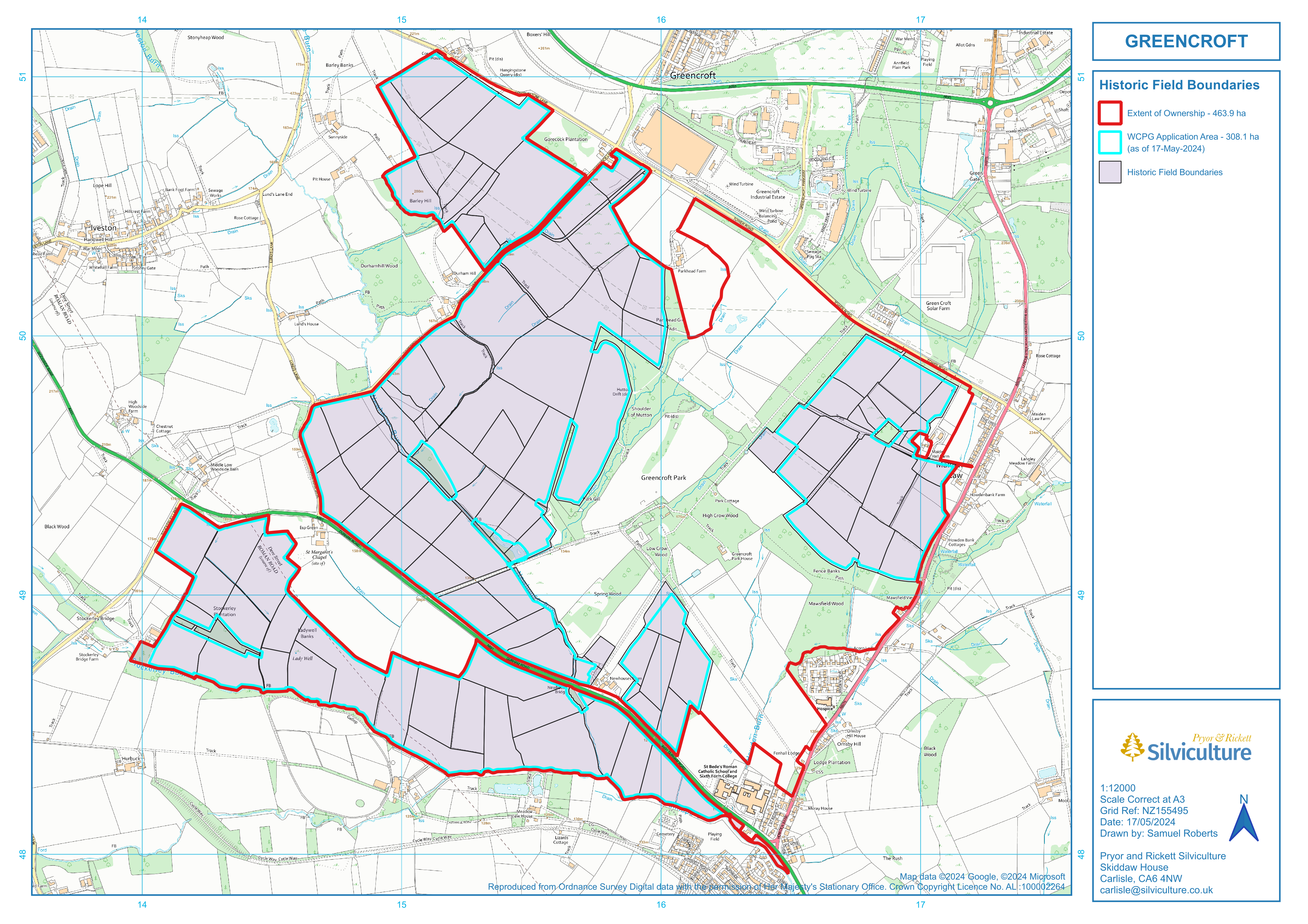
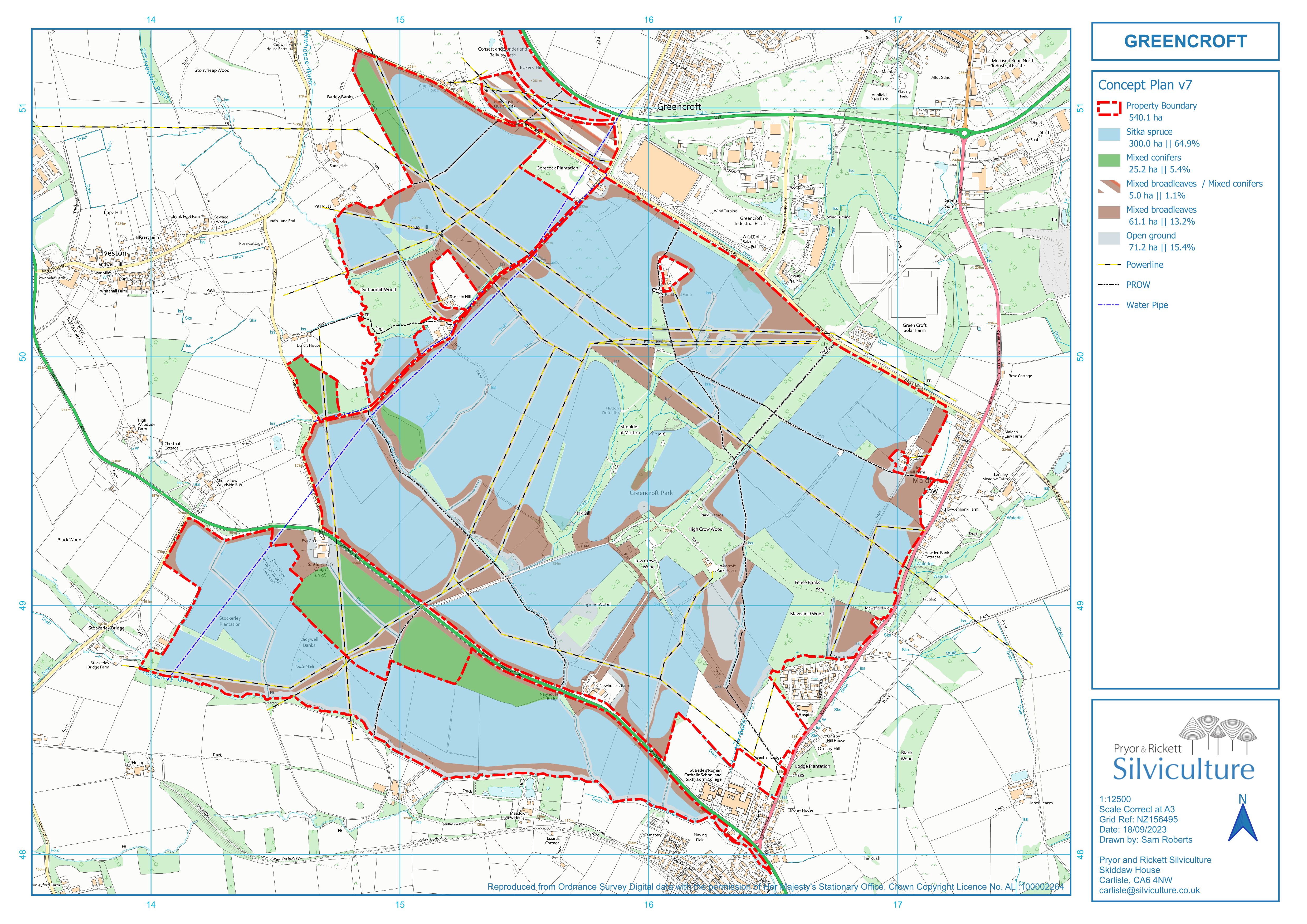
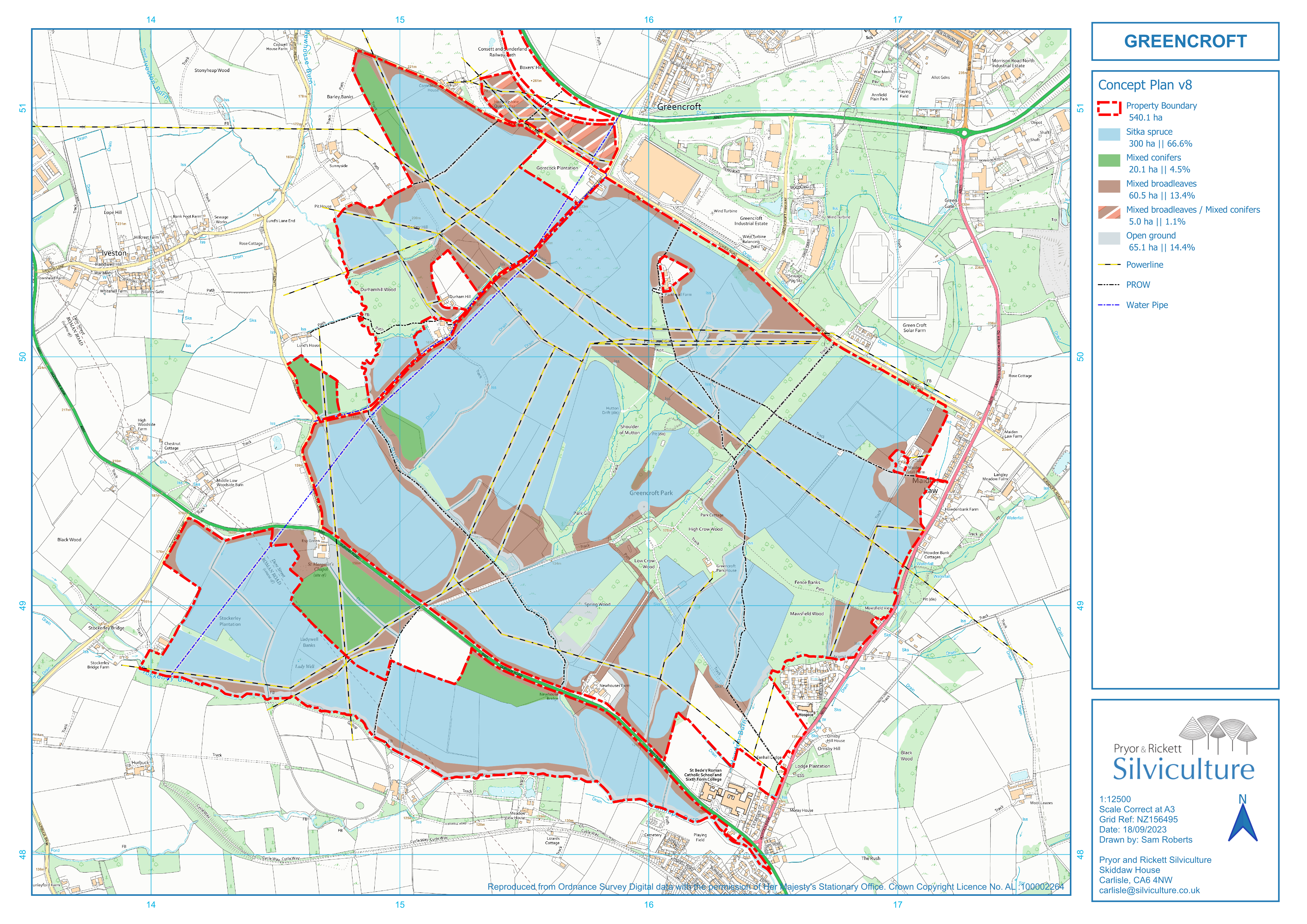
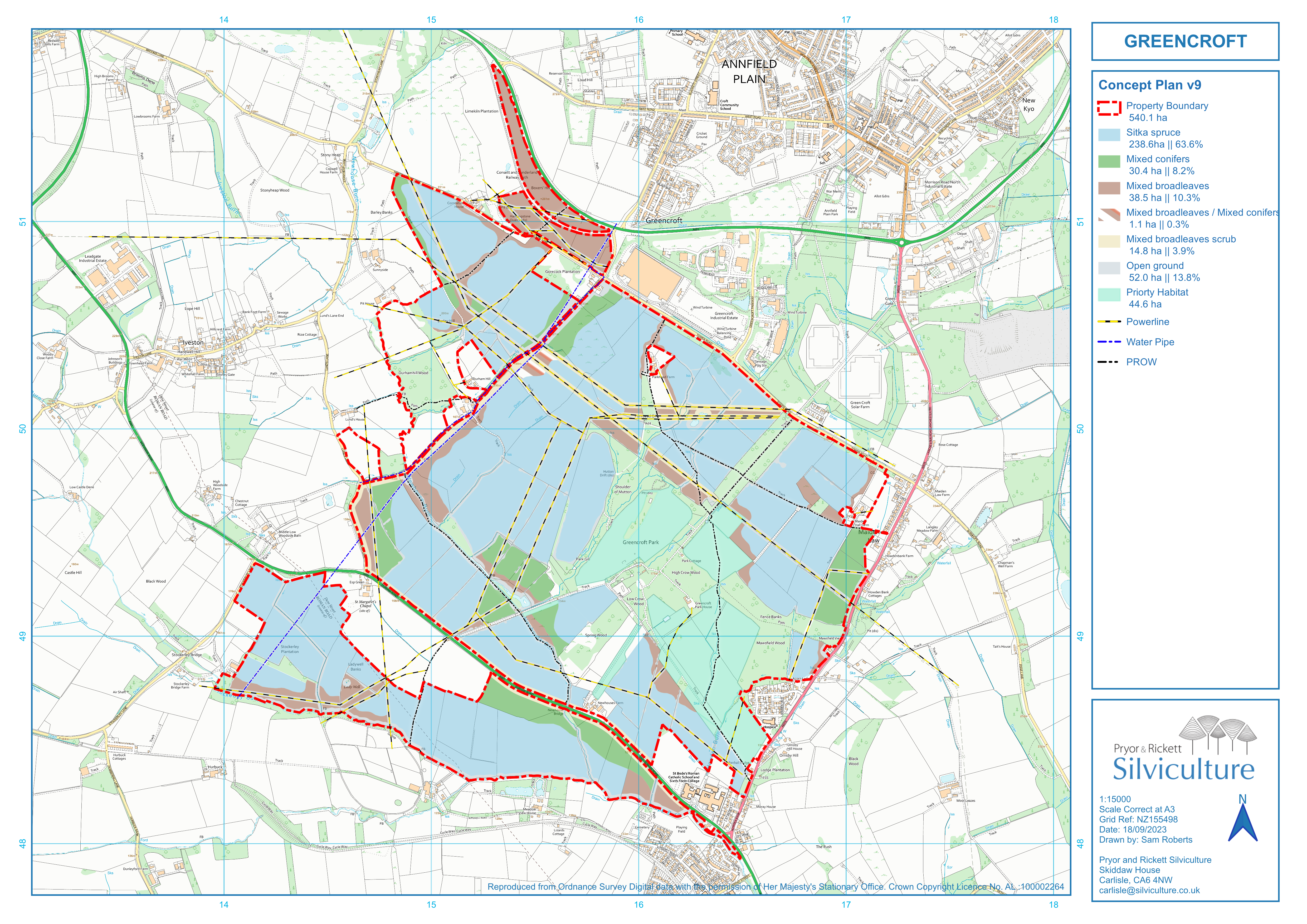
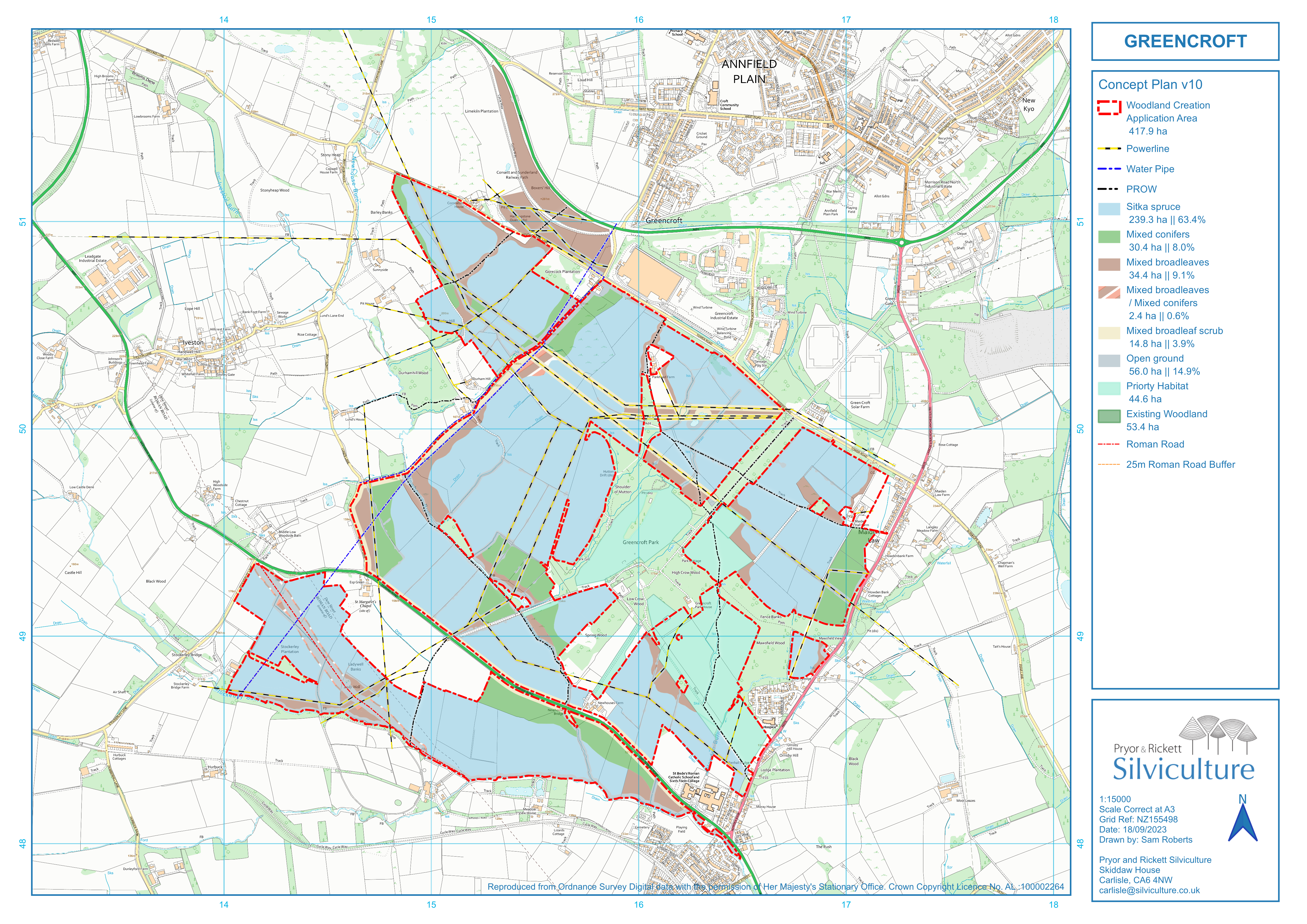
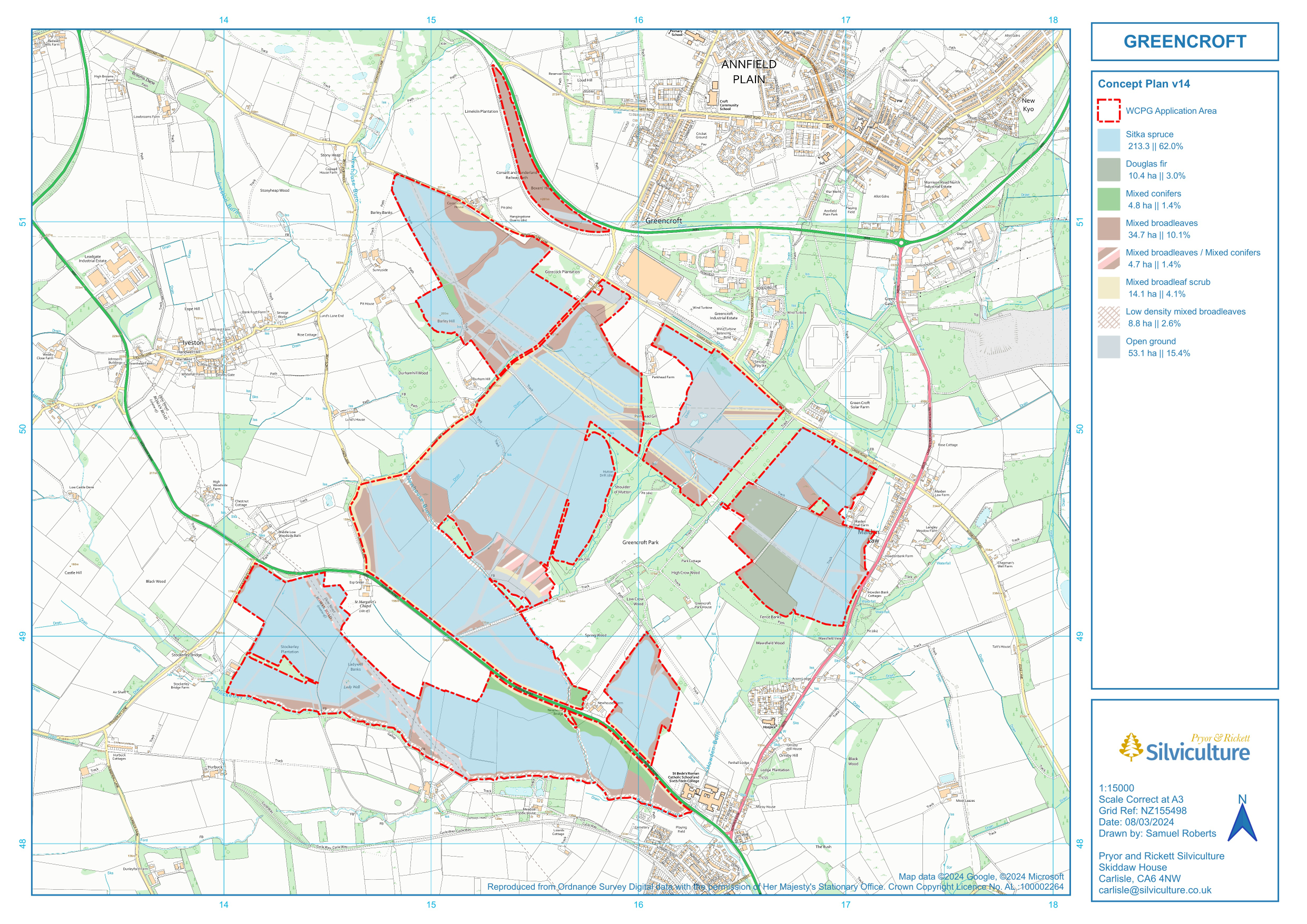
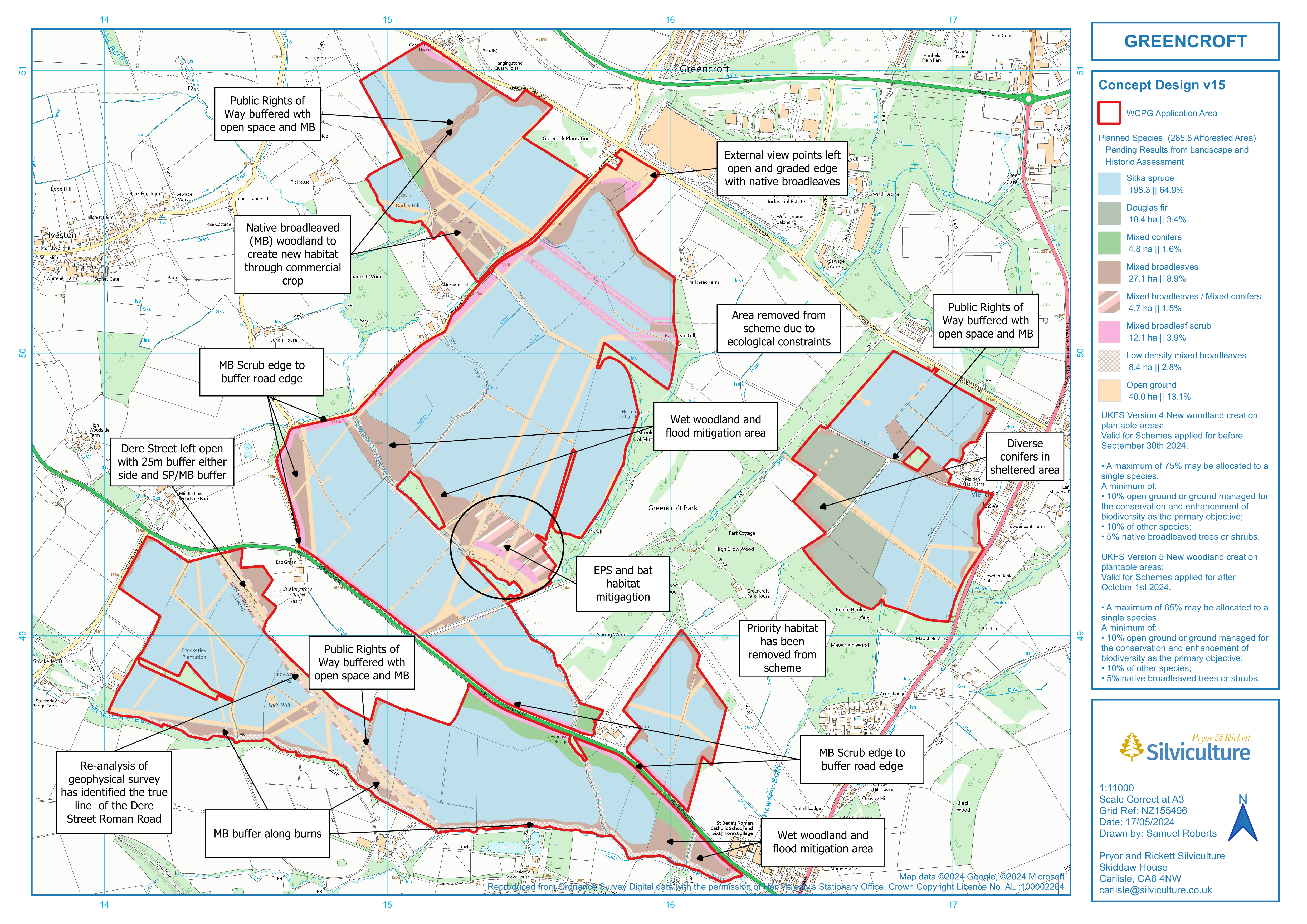
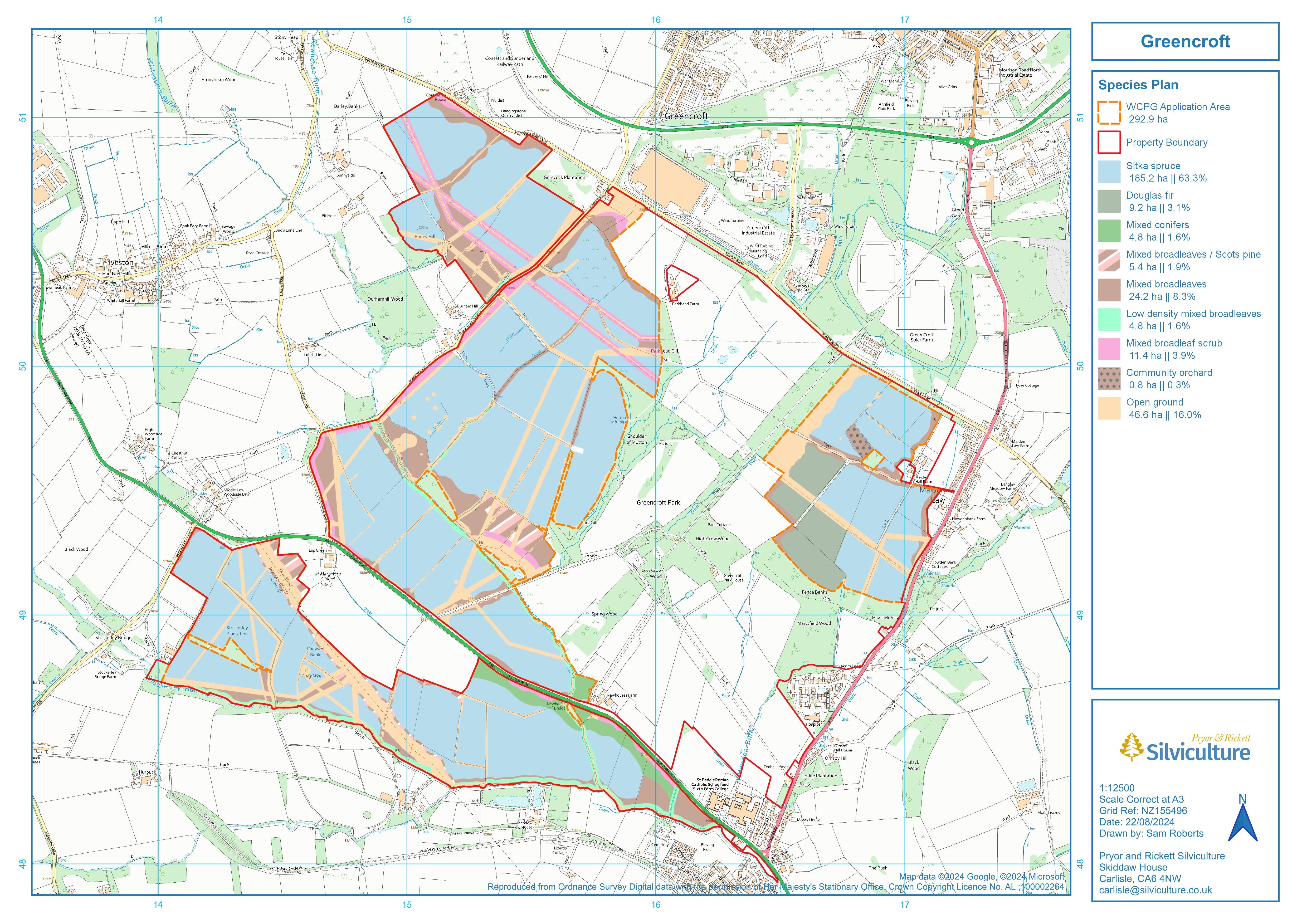
Woodland creation in England is governed by the Forestry Commission, and is underpinned by the legally binding UK Forestry Standard (UKFS).

Sustainable forest management involves ensuring that the production of all forest and woodland benefits is maintained over the long term. This is achieved when the environmental, economic and social functions of forests interact in support of each other. The precise point of balance between environmental, economic and social functions will vary in individual forests in response to management objectives and local circumstances. The concept of balanced objectives is central to the approach of the UKFS. Throughout the woodland creation planning process we liaise with a range of external consultants to ensure that the scheme we plan meets these balanced objectives in both a local and a national context.

The woodland design process is broken in to two stages which are guided by the Woodland Creation Planning Grant (WCPG).

Stage 1 of the WCPG is a desk based exercise that looks to identify the constraints and opportunities that may effect the proposed planting.
Stage 2 of the WCPG builds on the previous stage, and using the finding independent surveys we look to fit our design as sensitively in to the existing landscape as possible.
Once this process is complete, a grant application will be made through funding made available by DEFRA.

Further information on the differences between grant schemes can be found on Forestry Commission Website.

Greencroft has many constraints and opportunities to hang our design on. These include:

  • Overhead powerlines – working with the National grid, we have identified the suitable planting distances and open space that must be left to accommodate these.
  • Main water pipe – running alongside Gorecock lane, we will ensure to maintain the appropriate distances to ensure services are not disrupted.
  • Dere Street Roman Road – we have undertaken geophysical surveys to identify the location of the roman road. In this instance it is 100m further south then previously mapped.
    The centreline of the road has been buffered to 5m, and then a variable 20m buffer has been added on top of these. This leaves a total of 50m of open space to highlight the route
    of the road with the variable 20m buffer being used to create scalloped edges and design interest.
  • Newhouse, Howden, and Stockerley Burns – the site drains in to these Burns which, eventually, run through Lanchester. We are using suitable riparian planting to help buffer these
    watercourse from spates of water and improve biodiversity in the Burns themselves.
  • There are various heritage features across the site which will have been associated with the former estate house. Where the application area overlaps these features they will be treated
    sensitively so their prominence is not lost.
  • Existing woodland – The existing mixed estate woodland provides a ready made source of biodiversity on the site. By planting trees around these woodland we will create corridors for
    wildlife to expand their areas of forage and provide safe routes for the movement of animals and birds across the landscape.
  • Existing public access – There are four public rights of way across the site. Where appropriate we are looking to formalise existing desire lines to create a loop walk within the boundary,
    giving local users further greenspace away from the roads.
  • Local park of historic interest – we are investigating the state of the parkland and its biological value.
  • Priority habitat – this is associated with the local parklands and is under investigation by independent ecologists.
  • Diverse bird population – of the 76 bird species recorded across the site, three quarters are associated with woodland or woodland edge habitat.

Designing a mixed productive forest around these features will allow us to facilitate a whole host of benefits to nature and the community.  Some of the tree species we are planning to use to create a diverse productive forest are:
Native/naturalised broadleaves such as: oak, beech, lime, birch, aspen, alder, black poplar, maple, rowan, wild cherry, hawthorn, willow, holly, and sweet chestnut.
Conifer species such as: Scots pine, yew, Sitka spruce, Norway spruce, Douglas fir, grand fir, hemlock, cedar, and redwood species

To date we have worked through 10 design concepts. These have evolved as new opportunities & constraints have been identified and as the property boundary has changed.
Under UKFS version 4, all woodland creation schemes applied for before September 30th 2024 must follow a strict percentage mix of species:

  • A maximum of 75% of a single species
  • A minimum of 10% open space (or ground  managed for the conservation and enhancement of biodiversity as the primary objective)
  • A minimum of 10% other species
  • A minimum of 5% native broadleaved trees or shrubs.

As of October 1st 2024, all woodland creation schemes must follow UKFS version 5 and comply to the following percentage mix of species:

  • A maximum of 65% of a single species
  • A minimum of 10% open space (or ground  managed for the conservation and enhancement of biodiversity as the primary objective)
  • A minimum of 10% other species
  • A minimum of 5% native broadleaved trees or shrubs.

Our latest concept plan (v15) complies to the species percentage mix as specified in UKFS version 5.